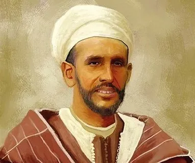
Centuries before GPS put the entire world at our fingertips, man relied on the work and research of cartographers to find his bearings in the world. One of the best-known cartographers, who published the first representations of the world, was the Moroccan geographer, traveler and scholar Charif al-Idrissi. Al-Idrissi’s book, “Tabula Rogeriana” (known in Arabic as “Nuzhat al-Mushtaq Fi'khtiraq Al-afaq ”) has the incredible renown of being one of the greatest works of medieval geography and cartography.
Of al-Idrissi, we know that he was born in Ceuta in 1100, when the territory was governed by the Moroccan dynasty of the Almoravids. He came from a noble family, affiliated with Idris I, uncle of the prophet Muhammad and founder of the city of Fes in the 8th century, as well as of the Idrisid dynasty, which will be the first modern Moroccan state. An explorer at heart, he will already have made several journeys during his youth through a good part of the Mediterranean, the Maghreb, the Hejaz, Egypt and Asia Minor.

He grew up in Cordoba, city of the caliph and the intellectual as well as cultural center of the Almoravid empire, an empire in which he will pursue his university studies. After the fall of Cordoba, he will find refuge in Sicily, where he will be welcomed by the Norman king Roger II and will then be engaged by the latter as his official geographer.
Al-Idrissi will craft two prototypes of the very first world map at the behest of the king of Sicily: one on a silver sphere, and the other on a flat silvered board. A second commission from the king concerned the writing of al-Idrissi’s celebrated work (Tabula Rogeriana), including more than 70 drawn maps, which he completed in 1154, shortly before his death. Al-Idrissi will lead a life filled with travels and collaborations with various envoys for his works, and he will draw on many ancient maps and accounts of Moorish explorers to support his work. In the end, it will have taken him 18 years of exploration and research to complete the task.
Al-Idrissi has been considered one of the most important medieval geographers, given the quantity of geographical information he collected. Likewise, he supported the theory of the sphericity of the Earth and, although his maps had a circular shape, he explained that the disk merely symbolized the shape of the world.
The earth is round like a sphere; if this were not the case, how would the water hold upon it?

Throughout the 20th century, al-Idrissi’s map will be the subject of numerous historical studies devoted to particular regions, such as the British Isles, Scandinavia, Germany, Spain, Bulgaria, Africa and India. “Tabula Rogeriana” remained for nearly three centuries one of the most advanced medieval world maps, used by explorers such as Ibn Battuta, Ibn Khaldun, Piri Reis, Christopher Columbus and Vasco Da Gama for their discoveries and their voyages.
Among these works, some ten manuscripts of al-Idrissi’s Treatise were preserved across the world. Several theories circulate as to the place of his death; indeed, the place of his burial is unknown, though he is said to have passed away in 1165 in Sicily.